East Lothian (/ˈloʊðiən/; Scots: East Lowden; Scottish Gaelic: Lodainn an Ear) is one of the 32 council areas of Scotland, as well as a historic county, registration county and lieutenancy area. The county was also known as Haddingtonshire.
In 1975, the historic county was incorporated for local government purposes into Lothian Region as East Lothian District, with some slight alterations of its boundaries. The Local Government etc. (Scotland) Act 1994 later created East Lothian as one of 32 modern council areas. East Lothian lies south of the Firth of Forth in the eastern central Lowlands of Scotland. It borders Edinburgh to the west, Midlothian to the south-west and the Scottish Borders to the south. Its administrative centre and former county town is Haddington while the largest town is Musselburgh.

Haddingtonshire has ancient origins and is named in a charter of 1139 as Hadintunschira and in another of 1141 as Hadintunshire. Three of the county’s towns were designated as royal burghs: Haddington, Dunbar, and North Berwick.
As with the rest of Lothian, it formed part of the Anglo-Saxon kingdom of Bernicia and later the Kingdom of Northumbria. Popular legend suggests that it was at a battle between the Picts and Angles in the East Lothian village of Athelstaneford in 823 that the flag of Scotland was conceived. From the 10th century, Lothian transferred from the Kingdom of England to the authority of the monarchs of Scotland. It was a cross-point in battles between England and Scotland and later the site of a significant Jacobite victory against Government forces in the Battle of Prestonpans. In the 19th century, the county is mentioned in the Gazetteer for Scotland as chiefly agricultural, with farming, fishing and coal-mining forming significant parts of the local economy.
History.

Early history.
Following the end of the Roman occupation of Britain, Lothian was populated by Brythonic-speaking Ancient Britons and formed part of the kingdom of the Gododdin, within the Hen Ogledd or Old North. In the 7th century, all of the Gododdin’s territory fell to the Angles, with Lothian becoming part of the kingdom of Bernicia.
Bernicia united into the Kingdom of Northumbria which itself became part of the early Kingdom of England. Lothian came under the control of the Scottish monarchy in the 10th century.
The earliest reference to Haddingtonshire as a county of Scotland occurred in the 12th century, in two charters issued by King David.
Medieval and early modern period.

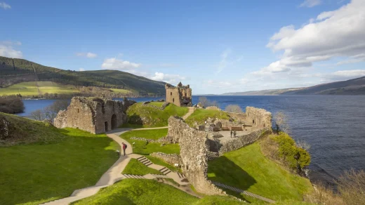
Haddingtonshire was heavily involved in several medieval and early modern conflicts and several fortified castles and buildings such as Dunbar Castle, Tantallon Castle and Dirleton Castle date from this period.
In the 12th and 13th centuries, the Palace of Haddington was one of the seats of the Kings of Scotland. King William the Lion of Scotland used the palace from time to time and it was the birthplace of Alexander II in 1198.[3] The palace and town were burned and pillaged in 1216, by an English army under the command of King John of England. In 1296, the Battle of Dunbar was a decisive victory for the forces of Edward I of England against the forces of John Balliol, the Scottish king who was Edward’s vassal.
East Lothian was also the site of conflict during the war of the Rough Wooing, with many houses and villages burnt by the English in May 1544 after the sacking of Edinburgh, the Scottish defeat at the battle of Pinkie, Dunbar Castle burnt in 1548, and the siege of Haddington. East Lothian lairds supported the English cause, including John Cockburn of Ormiston, Alexander Crichton of Brunstane, and Regent Arran demolished their houses.
During the War of the Three Kingdoms, another Battle of Dunbar took place in 1650 between Scottish Covenanter forces and the Parliamentary forces under Oliver Cromwell. The Parliamentary forces were victorious and able to march on to take Edinburgh.
Following the Restoration of the monarchy, Glorious Revolution and Acts of Union, Jacobite forces conflicted with Government forces, with the main conflict taking place as part of the 1715 Rising and 1745 Rising. Under the command of Sir John Cope, the British Army met with the Jacobites under Charles Edward Stuart at the Battle of Prestonpans in the west of the county in September 1745, with the Jacobite side gaining a significant victory before being defeated at the Battle of Culloden in April 1746.
Modern history.
County Buildings in Court Street, Haddington, the former headquarters of East Lothian County Council

The local government saw major reforms in Scotland by the Local Government (Scotland) Act 1889, which gave Haddingtonshire a county council, replacing earlier functions of the Commissioners of Supply and local Justices of the Peace. East Lothian County Council was based at County Buildings in Court Street, Haddington.[4]
In 1975 under the Local Government (Scotland) Act 1973, Scotland’s county councils were dissolved and a new system of regional and district councils was created. East Lothian District was created within the wider Lothian region. The district comprised the historic county of East Lothian plus the burgh of Musselburgh and the parish of Inveresk (which included Wallyford and Whitecraig) from the county of Midlothian.
When further reforms in 1996 moved Scotland to a system of 32 unitary local authorities, the modern council area of East Lothian was created.
Geography
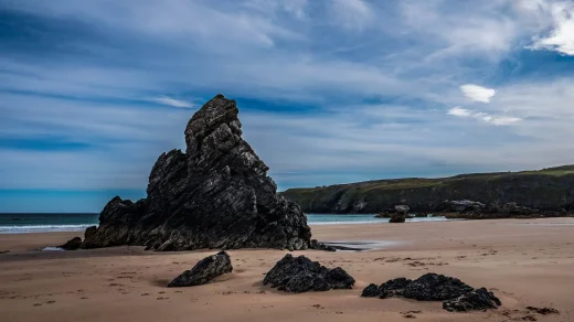
East Lothian is predominantly rural. It has 40 miles (64 km) of coastline where the towns of Musselburgh, Prestonpans, Cockenzie and Port Seton, Gullane, North Berwick and Dunbar lie along the coast of the Firth of Forth. The coast has several headlands and bays, most notably Gosford Bay, Aberlady Bay, Gullane Point, Sandy Hirst, Tyne Mouth, Belhaven Bay, Barns Ness, Chapel Point and Torness Point. There are several small islands off the coast north of North Berwick, the largest of these being Fidra, Lamb, Craigleith and Bass Rock.
Only two towns are landlocked, Tranent and Haddington. To the south are the Lammermuir Hills along the boundary with Berwickshire; it is here that Meikle Says Law, the highest point in the county at 535 metres (1,755 ft), can be found. The River Tyne flows through Haddington and several of East Lothian’s villages, reaching the Firth of Forth near Belhaven. The River Esk flows through Inveresk and Musselburgh where it empties at the north of the town into the Firth of Forth. Major bodies of water include Pressmennan Lake, the Whiteadder Reservoir, Hopes Reservoir, Stobshiel Reservoir and Lammerloch Reservoir.


.jpg)