Angus (Scots: Angus; Scottish Gaelic: Aonghas) is one of the 32 local government council areas of Scotland, a registration county and a lieutenancy area. The council area borders Aberdeenshire, Dundee City and Perth and Kinross. Main industries include agriculture and fishing. Global pharmaceuticals company GSK has a significant presence in Montrose in the north of the county.
Angus was historically a province, and later a sheriffdom and county (known officially as Forfarshire from the 18th century until 1928), bordering Kincardineshire to the north-east, Aberdeenshire to the north and Perthshire to the west; southwards it faced Fife across the Firth of Tay; these remain the borders of Angus, minus Dundee which now forms its own small separate council area). Angus remains a registration county and a lieutenancy area. In 1975 some of its administrative functions were transferred to the council district of the Tayside Region, and in 1995 further reform resulted in the establishment of the unitary Angus Council.
Etymology
The name “Angus” indicates the territory of the eighth-century Pictish king of that name.
Prehistory
The area that now comprises Angus has been occupied since at least the Neolithic period. Material taken from postholes from an enclosure at Douglasmuir, near Friockheim, about five miles north of Arbroath has been radiocarbon dated to around 3500 BC. The function of the enclosure is unknown, but may have been for agriculture or for ceremonial purposes.
Bronze Age archaeology is to be found in abundance in the area. Examples include the short-cist burials found near West Newbigging, about a mile to the North of the town. These burials included pottery urns, a pair of silver discs and a gold armlet. Iron Age archaeology is also well represented, for example in the souterrain nearby Warddykes cemetery and at West Grange of Conan, as well as the better-known examples at Carlungie and Ardestie.
Medieval history
The county is traditionally associated with the Pictish territory of Circin, which is thought to have encompassed Angus and the Mearns. Bordering it were the kingdoms of Cé (Mar and Buchan) to the North, Fotla (Atholl) to the West, and Fib (Fife) to the South. The most visible remnants of the Pictish age are the numerous sculptured stones that can be found throughout Angus. Of particular note are the collections found at Aberlemno, St Vigeans, Kirriemuir and Monifieth.
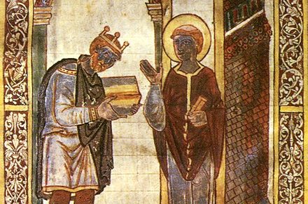
Angus is first recorded as one of the provinces of Scotland in 937, when Dubacan, the Mormaer of Angus, is recorded in the Chronicle of the Kings of Alba as having died at the Battle of Brunanburh.[6]
Angus is marketed as the birthplace of Scotland. The signing of the Declaration of Arbroath at Arbroath Abbey in 1320 marked Scotland’s establishment as an independent nation. It is an area of rich history from Pictish times onwards. Notable historic sites in addition to Arbroath Abbey include Glamis Castle, Arbroath Signal Tower museum and the Bell Rock Light House.
Geography
Craigowl Hill, highest of the Sidlaws, in southern Angus.

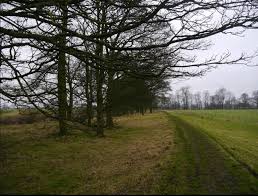
Angus can be split into three geographic areas. To the north and west, the topography is mountainous. This is the area of the Grampian Mountains, Mounth hills and Five Glens of Angus, which is sparsely populated and where the main industry is hill farming. Glas Maol – the highest point in Angus at 1,068 m (3,504 ft) – can be found here, on the tripoint boundary with Perthshire and Aberdeenshire. To the south and east the topography consists of rolling hills (such as the Sidlaws) bordering the sea; this area is well populated, with the larger towns. In between lies Strathmore (the Great Valley), which is a fertile agricultural area noted for the growing of potatoes, soft fruit and the raising of Aberdeen Angus cattle.
Montrose in the north east of the county is notable for its tidal basin and wildlife. Angus’s coast is fairly regular, the most prominent features being the headlands of Scurdie Ness and Buddon Ness. The main bodies of water in the county are Loch Lee, Loch Brandy, Carlochy, Loch Wharral, Den of Ogil Reservoir, Loch of Forfar, Loch Fithie, Rescobie Loch, Balgavies Loch, Crombie Reservoir, Monikie Reservoirs, Long Loch, Lundie Loch, Loch of Kinnordy, Loch of Lintrathen, Backwater Reservoir, Auchintaple Loch, Loch Shandra, and Loch Esk.
Demography
Population structure
| Year | Pop. | ±% |
|---|---|---|
| 1801 | 65,068 | — |
| 1811 | 69,376 | +6.6% |
| 1821 | 74,436 | +7.3% |
| 1831 | 84,630 | +13.7% |
| 1841 | 106,890 | +26.3% |
| 1851 | 119,357 | +11.7% |
| 1911 | 118,748 | −0.5% |
| 1921 | 101,767 | −14.3% |
| 1931 | 93,803 | −7.8% |
| 1941 | 95,290 | +1.6% |
| 1951 | 96,777 | +1.6% |
| 1961 | 93,666 | −3.2% |
| 1971 | 90,554 | −3.3% |
| 1981 | 98,685 | +9.0% |
| 1991 | 107,866 | +9.3% |
| 2001 | 108,400 | +0.5% |
| 2011 | 116,000 | +7.0% |
| Source: |
In the 2001 census, the population of Angus was recorded as 108,400. 20.14% were under the age of 16, 63.15% were between 16 and 65 and 18.05% were aged 65 or above.
Of the 16 to 74 age group, 32.84% had no formal qualifications, 27.08% were educated to ‘O’ Grade/Standard Grade level, 14.38% to Higher level, 7.64% to HND or equivalent level and 18.06% to degree level.

