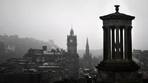
Airdrie (/ˈɛərdri/; Scots: Airdrie; Scottish Gaelic: An t-Àrd Ruigh) is a town in North Lanarkshire, Scotland. It lies on a plateau roughly 400 ft (130 m) above sea level, and is approximately 12 miles (19 km) east of Glasgow city centre. As of 2012, the town had a population of around 37,130.[3][4][5] Historically part of Lanarkshire, Airdrie forms part of a conurbation with its neighbour Coatbridge, in what is commonly known as the Monklands, formerly a district. (population approximately 90,000 including outlying settlements).

Name
Airdrie’s name first appeared in the Register of the Great Seal of Scotland (Registrum Magni Sigilii Regum Scotorum) in 1373 as Ardre. By 1546 it had become Ardry and by 1587 it was known as Ardrie. In 1630 it finally appeared in the Register as Airdrie. Given the topography of the area, the most likely interpretation is that the name derives from the Gaelic An Àrd Ruigh meaning a level height or high pasture land. Another possibility is that it is from the Gaelic An Àrd Àirighe meaning a sheiling, a summer pasture/shepherd’s hut. A third possibility is the Gaelic Ard Reidh meaning a high plain. A further, non-Gaelic alternative is the Brythonic, i.e. Cumbric or North Welsh, ard tref (becoming ardre by process of assimilation), meaning a high steading or farmstead, which would date back to the times of the Kingdom of Strathclyde, before the expansion of Gaelic or English speech into the region. Airthrey Castle in Stirlingshire may have a similar derivation.
Airdrie Town House

There is no evidence to support the claim (George Chalmers, Caledonia) that Airdrie is the site of the ancient battle of Arderyth. Under the patronage of King Malcolm IV of Scotland Cistercian monks established an abbey at Melrose in 1136. Five years later a daughter house was founded at Newbattle Abbey in Lothian. In 1160, Malcolm granted lands in central Scotland to the monks of Newbattle. These became known as the “Munklands” (Register of the Great Seal 1323).
Malcolm’s Charter constitutes the oldest documentary record of place-names in the Monklands. The area of land granted by the Charter is clearly defined by direct reference to geographical and topographical features thus: Dunpeldre by its right boundaries, namely with Metheraugh and Mayeuth and Clarnephin as far as Dunduffes in the east. The name Dunpeldre is found in the modern name Drumpellier, Metheraugh is Medrox; Mayeuth is Myvot and Clarnephin refers to the North Calder Water in the east of the parish (from old Brittonic name claur n afon meaning plain of the river). Dunduffes has become directly translated into the modern Black Hill which, as the Charter states, lies at the eastern extremity of the parish. The Charter does not mention anything resembling Airdrie, although this is where Airdrie is located.
Airdrie owes its existence to its location on the ‘Hogs Back’ – a ridge of land running from east to west. One very important aspect of the town’s history was the Cistercian monks of Newbattle Abbey, which is why the area is called the Monklands. The monks were farmers and some of their place names survive, e.g., Ryefield and Whifflet (the wheat flats). Much of the land they used is known today as ‘The Four Isles’ (a housing estate named after four Scottish islands): Mull, Islay, Iona and Luing in the Petersburn area of modern Airdrie. The monks of Newbattle had numerous establishments throughout the area including a farm grange at Drumpellier, Coatbridge, a court house at Kipps, a chapel in the area of Chapelhall and a number of corn mills. The Monks were also expert in the construction of roads. In the 12th century, they established the original Glasgow to Edinburgh road via Airdrie and Bathgate, to link up with their lands in Newbattle in East Lothian.
The Robert Hamilton Memorial.
Definitive evidence of the existence of Airdrie as a tenantry was only made clear in 1503. The old monks’ road was via Cliftonhill (an area now in neighbouring Coatbridge), Airdrie House (now the site of Monklands Hospital), Aitchison Street, High Street, Hallcraig Street, Flowerhill Street and Colliertree Road. The first houses in Airdrie were built along this road. Development was slow and it was only around 1650 that evidence of the number of inhabitants was known at around 500 for the Airdrie area. A large contingent of Airdrieonians fought at the Battle of Bothwell Brig during the Covenanter Rebellion of 1679; their banner can still be viewed at the local library.
A significant event in Airdrie’s history was the 1695 passing of a special Act of Parliament in the Scottish Parliament allowing Robert Hamilton of Airdrie to hold four fairs yearly and a weekly market in the town of ‘Airdry’. This helped develop Airdrie from a ‘farm town’ into a thriving ‘market town’.
However, Airdrie really came to prominence through its weaving industry. Airdrie Weavers Society was founded in 1781 and flax was being grown in sixteen farms in and around the burgh. In the last decade of the eighteenth century, coal mining was in progress and around thirty colliers were employed. Weaving continued to flourish making up a substantial part of the population of over 2,500 around the turn of the 19th century.
Given its large number of weavers, its geographic location and a large number of unemployed soldiers following the end of the Napoleonic Wars, Airdrie became a major centre of support for the Radical War of 1820. The rapid pace of population growth continued and by 1821 there were 4,862 inhabitants. At this time, the number of houses being built increased dramatically and in 1821, by a private Act of Parliament, Airdrie became a free and independent Burgh of Barony.
Voting in the early part of the nineteenth century was rather hit or miss as not only locals but residents outside the burgh were allowed to vote. In 1821, the first election of a town council took place and by August it had appointed an assessor, procurator fiscal, master of police and a town crier. Anyone who had paid their 3 guineas was allowed to vote; there is even a record of a John Mackay voting despite being under 10 years old.
In 1824, it was decided to build the Airdrie Town House, originally designed by Alexander Baird and now a local landmark known as the ‘town clock’. In 1832, the Town House was used as a hospital due to the cholera outbreak of this year.
1850 to 1920
Sir John Wilson Town Hall

The enormous growth in population was not due to high birthrate, but instead due to an influx of residents from the Highlands and predominantly Ireland. This followed the Highland potato famine of the mid-1840s and also reflected the change from cottage industry to heavy industry in the area. Most of the Irish immigrant population were involved with mining and labouring. This led to an increase in ironwork foundries around the area. Because of this explosion in industry, railway links were established starting in 1826. By 1862, the Airdrie and Bathgate Junction Railway provided a direct link to Edinburgh with Airdrie South Station providing the starting point for trains to Glasgow.
In August the Public Libraries Act (Scotland) 1853 was passed, and in November Airdrie Public Library became the first in Scotland.
Rear of Airdrie library with Observatory Dome

The dramatic rise in population and industry prompted the need for more accessible water supplies. Until the mid-1800s, various wells were put in place feeding from surrounding streams in the area. These served to provide many houses with private wells. By 1846 Airdrie and Coatbridge Water Company was founded to construct (along with Forth and Clyde Canal Company) the reservoir at Roughrigg.
Journalism in Airdrie began with “The Airdrie Literary Album” in 1828. Several local newspapers began appearing around this time notably the Airdrie & Coatbridge Advertiser in 1855, which is still the most popular local paper today. The prison was legalised in 1859 and had 51 cells.
Airdrie Working Men’s Club was established in 1869. Also around this time, football and cricket began to emerge as popular sports. Following the codification of association football rules a local team called Excelsior was formed in 1878 which would later be renamed Airdrieonians. Horse race meetings were also held in the town (1851–1870) but this land became the golf course for the newly formed Airdrie Golf Club in 1877.
Education posed a major problem with severe overcrowding in the few schools available, therefore three new school boards were established. In the early 1830s there were about 800 pupils while the town had about 7000 residents. Fees were routinely charged within the schools with the belief they should be self-supporting until a parliamentary act of 1889 relieved some of the infant classes in schools of this burden. Airdrie Academy was built in 1849 and by 1919 all school boards were dissolved and Lanarkshire Education Authority took over responsibility for education throughout Lanarkshire.
Airdrie Public Observatory, one of only four public observatories in the UK (Second Oldest and Smallest)- all in Scotland, was founded in the first library building in 1896, and is still operated in the present building by the Airdrie Astronomical Association a Scottish astronautic and astronomy society and registered charity.
By the turn of the century variety shows were becoming popular in the area and by 1911 the Pavilion in Graham Street was built which after initially being used as a music hall started showing cinematographic pictures. Unfortunately it was destroyed by fire in 1917 but was rebuilt in 1919 and finally closed in 1970. The New Cinema was opened in 1920 in Broomknoll Street but it too has since closed. The town had no suitable venue for larger functions so in 1912 the Sir John Wilson Town Hall was opened (following an offer of £10,000 from Sir John Wilson).
On 9 July 1918 nineteen miners died in the Stanrigg Pit Disaster. The pit was situated in boggy land and collapsed after being saturated by heavy rainfall.
1920 onwards
Airdrie War Memorial
At the end of the First World War, Airdrie was hard hit with many casualties from the war. Unemployment reached 30% in the local area. After years of moving from one site to another, the first purpose built library in Airdrie was opened in Anderson Street in 1895. However, this only lasted 30 years until the current Airdrie Library building was erected in 1925.
Conditions in the town did not really improve until well after the Second World War but in 1949 the Boots pharmaceutical company and Banner Textiles Ltd were attracted to the town (between them employing 1200). With this impetus, new companies began to consider Airdrie as a viable option for business and in 1958 Pye opened employing over 1000 people. The emergence of industrial estates was also prevalent around this time (Newhouse, Chapelhall, and Brownsburn). The Airdrie Arts Centre opened in 1967 in the former Airdrie Library building, and was a popular venue for concerts and plays, but was closed in 2012 by North Lanarkshire Council.
Between 1964 and 1991, the town was the location of a Royal Observer Corps monitoring bunker, to be used in the event of a nuclear attack. No trace remains today.
The Holehills Flats
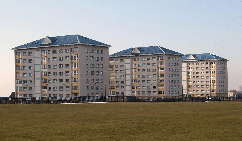
The 1970s saw the opening of Monklands Hospital, which replaced an older hospital on the Airdrie House estate. Airdrie hosted the National Mòd in 1993.