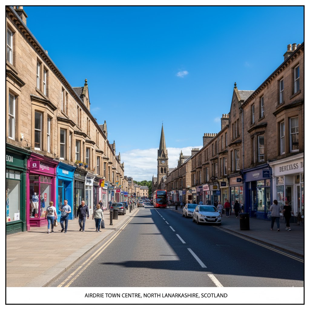
Airdrie is a town in North Lanarkshire, Scotland. It lies on a plateau roughly 400 ft (130 m) above sea level, and is approximately 12 miles (19 km) east of Glasgow city centre. As of 2012, the town had a population of around 37,130. Historically part of Lanarkshire, Airdrie forms part of a conurbation with its neighbour Coatbridge, in what is commonly known as the Monklands, formerly a district. (population approximately 90,000 including outlying settlements).
Airdrie’s name first appeared in the Register of the Great Seal of Scotland (Registrum Magni Sigilii Regum Scotorum) in 1373 as Ardre. By 1546 it had become Ardry and by 1587 it was known as Ardrie. In 1630 it finally appeared in the Register as Airdrie. Given the topography of the area, the most likely interpretation is that the name derives from the Gaelic An Àrd Ruigh meaning a level height or high pasture land. Another possibility is that it is from the Gaelic An Àrd Àirighe meaning a sheiling, a summer pasture/shepherd’s hut. A third possibility is the Gaelic Ard Reidh meaning a high plain. A further, non-Gaelic alternative is the Brythonic, i.e. Cumbric or North Welsh, ard tref (becoming ardre by process of assimilation), meaning a high steading or farmstead, which would date back to the times of the Kingdom of Strathclyde, before the expansion of Gaelic or English speech into the region. Airthrey Castle in Stirlingshire may have a similar derivation
There is no evidence to support the claim (George Chalmers, Caledonia) that Airdrie is the site of the ancient battle of Arderyth. Under the patronage of King Malcolm IV of Scotland Cistercian monks established an abbey at Melrose in 1136. Five years later a daughter house was founded at Newbattle Abbey in Lothian. In 1160, Malcolm granted lands in central Scotland to the monks of Newbattle. These became known as the “Munklands” (Register of the Great Seal 1323).
Malcolm’s Charter constitutes the oldest documentary record of place-names in the Monklands. The area of land granted by the Charter is clearly defined by direct reference to geographical and topographical features thus: Dunpeldre by its right boundaries, namely with Metheraugh and Mayeuth and Clarnephin as far as Dunduffes in the east. The name Dunpeldre is found in the modern name Drumpellier, Metheraugh is Medrox; Mayeuth is Myvot and Clarnephin refers to the North Calder Water in the east of the parish (from old Brittonic name claur n afon meaning plain of the river). Dunduffes has become directly translated into the modern Black Hill which, as the Charter states, lies at the eastern extremity of the parish. The Charter does not mention anything resembling Airdrie, although this is where Airdrie is located.
Please share me.

Discover more from WILLIAMS WRITINGS
Subscribe to get the latest posts sent to your email.